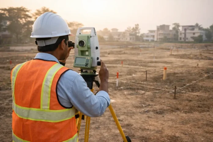

Boundary evidence does not always sit neatly inside the property being surveyed. Nearby markers may connect the parcel to an older survey network, confirm a shared corner, or reveal where a missing point should be restored. Access to those monuments helps a land surveyor compare written records with physical evidence before forming a professional boundary opinion.
Neighboring Monuments Connect One Parcel to the Larger Boundary Pattern
Property lines rarely function as isolated measurements. Each corner usually ties into adjoining parcels, subdivision control points, roadway markers, or earlier land divisions that establish how the area fits together. A monument located beyond the subject property may provide the strongest surviving link to that original layout.
Recorded deeds can describe lines through bearings and distances, but those figures may contain older measurement errors or copied wording. Physical markers give surveyors another source of evidence that can confirm whether the written description matches the land. Someone searching for a property surveyor near me may therefore see crew members working near an adjacent lot rather than staying only within the requested parcel.
Shared Corners Must Be Verified From More Than One Direction
A single corner can serve two, three, or even four properties. Surveyors test that location by measuring from other known monuments instead of accepting the first iron rod, pipe, or stone they find. Multiple connections help show whether the marker fits the recorded geometry of the surrounding tracts.
False markers can appear for many reasons. Fence installers, utility crews, builders, and previous owners sometimes place stakes or metal objects that resemble official corners. Careful verification protects the property owner from relying on an object that was never intended to establish a legal boundary.
Missing Markers Can Be Rebuilt From Nearby Evidence
Construction, erosion, landscaping, farming, and roadwork can remove or disturb boundary monuments. A missing point cannot simply be replaced at the end of one deed distance because the surrounding evidence may tell a different story. Nearby control points allow the land surveyor to calculate where the lost corner was originally positioned.
Restoration work often uses several independent measurements. Adjoining deeds, old plats, surviving pins, road rights-of-way, and occupation lines may all contribute to the final decision. Searches for a land surveyor near me should focus on professionals who perform full record research and field analysis rather than setting new markers from one isolated measurement.
Why Old Survey Control Still Matters Today
Earlier surveyors often established reference monuments that supported several parcels or an entire subdivision. Those points may sit across a road, behind a neighboring fence, or outside the immediate work area. Recovering them can show how the original survey was oriented and which measurement system guided the recorded boundaries.
Modern instruments provide far greater precision than older chains and compasses, yet accuracy alone does not rewrite established property lines. Surveyors must retrace the original work as closely as the available evidence allows. Reliable survey companies near me understand that a historic monument may carry more boundary value than a perfectly calculated point created today.
Access Does Not Mean Surveyors Can Enter Anywhere Without Care
Survey crews still need to respect ownership, gates, animals, crops, landscaping, and other site conditions. Access rules vary by location, so firms may contact neighboring owners, request permission, or coordinate entry before beginning work. Clear communication reduces concern when equipment appears near a fence or driveway.
Property owners can help by sharing known access limits before the scheduled field visit. Locked gates, aggressive dogs, hunting activity, steep ground, and sensitive planting areas may affect how the crew reaches a monument. Advance notice gives surveyors time to choose a safe route and avoid unnecessary damage.
A Property Line Survey Depends on Consistent Evidence
Boundary determination involves more than measuring the distance between two visible pins. Surveyors compare monuments, deed calls, plats, occupation features, and neighboring records to see whether the evidence supports one consistent location. Any disagreement must be studied rather than hidden or forced into a convenient result.
Strong consistency across several control points increases confidence in the survey. Conflicting positions may indicate a disturbed marker, an older drafting error, or a difference between record measurements and field conditions. People comparing surveyors near me should ask how the firm handles inconsistent monuments and whether adjoining evidence is included in the scope.
Nearby Markers Can Reveal Encroachments and Record Problems
Measurements from surrounding monuments may expose overlaps, gaps, misplaced fences, or improvements built across a recorded line. These findings do not automatically settle ownership, but they give property owners dependable information for discussions with neighbors, title professionals, or attorneys. Early discovery can also prevent a new project from adding to an existing boundary issue.
Accurate mapping becomes especially important before building a fence, driveway, addition, retaining wall, or utility connection. A property line survey can show where those improvements sit in relation to the retraced boundary. Better field evidence supports smarter decisions before excavation or construction begins.
Monument Access Helps Produce a Defensible Survey Plat
Final plats show more than parcel dimensions. Notes may identify monuments found, control points used, corners restored, easements located, and discrepancies discovered during the work. Documenting nearby evidence explains how the surveyor reached the reported boundary opinion.
Clients benefit from a map that another professional can follow and evaluate later. The Land Consultants provides land surveying and civil engineering services that include deed research, monument recovery, boundary analysis, and property line survey work, helping owners understand why access to neighboring control points may be necessary for a complete and dependable result.